by: Ammar Kannawi.
Translated by: Rim Lababidi
Documentation of Perils in Calcareous Block on the World Heritage Sites The Park Number /8/ – Alwastany Mountain[I]
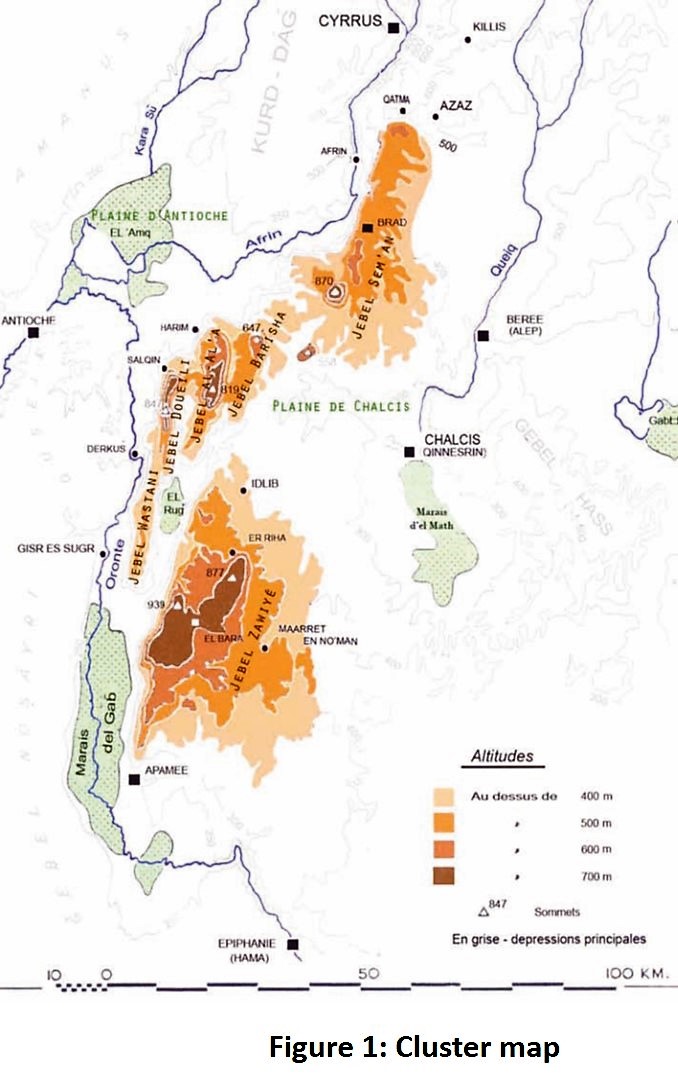
The archaeological villages of the Dead Cities located in northern Syria were inscribed on the World Heritage Sites list in 2011. The Lime Massif stretches around 20-40 km from the east to the west and 120 km from the north to the south, and it extends from the Syrian-Turkish borders in the north to the archaeological site of Apamea in the south. The Northern borders of the Lime Massif meet the site of Cyrrus/Al-Nabi Houri around 70km north of Aleppo, around half the road between Antakya and Zogma on the Euphrates. The Lime Massif is a karst part of the central mountains that spread around the Mediterranean Basin. The northern west of Syria, which is known as the Lime Massif is of a great importance because it has formed through the years a unique natural and cultural reserve. This region is known for scarcity of flowing water, and it consists of central mountains that vary in height and a series of valleys. The heights of the mountains range between 400m and over 900m. Two main blocks dominate this area, they are Al-Zawiya mountain and Samaan mountain, and they are separated by the fertile plain of Khalkees. These blocks are connected with Al-Assi Valley by a range of smaller mountains, which are Al-Wastany, Al-Aala, Al-Duwaili and Barysha.
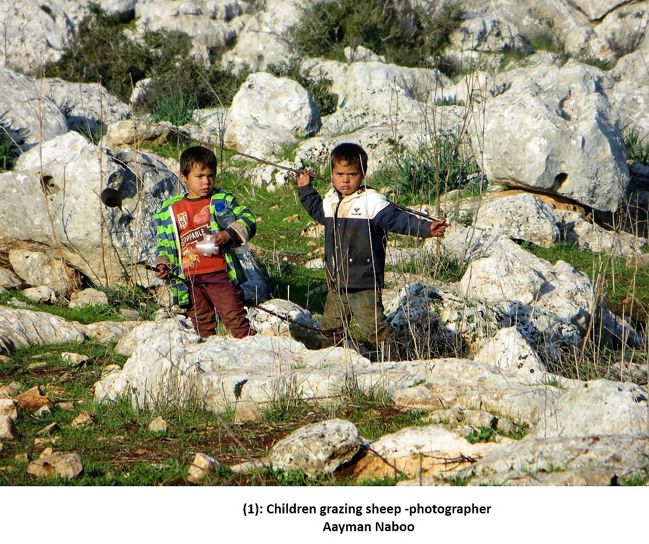
The region became inhabited in the 1st century A.D. by people who came from neighboring plains, and they practiced agricultural activities that depended mainly on vine and olives in addition to breeding cattle (sheep). Figure 1.
The World Heritage Site of the Dead Cities consists of a chain of eight geographically separated regions that belong to the same archaeological group and their monuments share the same architectural style.
The expansion of the regions differs but the area of each site doesn’t exceed tens of kilometers. They include well-known sites, such as Syrgilla and Samaan citadel, in addition to less famous sites that are similarly Important. There are also, small isolated and uninhabited sites, and other sites that have been partially occupied by modern housing, in addition to natural agricultural areas. Those eight regions extend all over the main ranges that form the Lime Massif, and they illustrate the complexity of the site and its richness.
[1] – A project of documentation to the Archaeological park in the Alwastany mount has been done under a scientific supervision by the D. Abdalrazzaq Moaz and by financing from Girda Hankle the Germany foundation.
[1] – A project of documentation to the Archaeological park in the Alwastany mount has been done under a scientific supervision by the D. Abdalrazzaq Moaz and Sponsored by Gerda Henkel Foundation.
Al-Wastany Mountain (The Central Mountain)
Al-Wastany Mountain is the last range of mountains towards the west with 32km long 6km wide, and it covers an area of about 173square kilometers. This mountain consists of different topographical elements and it has the natural and agricultural characteristics of the Lime Massif. Al-Wastany Mountain is bordered by Ad-Dwily mountain to the north, Al-Ghab plain to the south, the fertile plain of Al-Rooj to the east, and Al-Assi river to the west. The mountain is part of the Idlib governorate.
Al-Wastany Mountain consists of a wide valley that rises 700m above sea level. The site includes about 75 archaeological Roman-Byzantine villages, 52 of the villages are occupied in the present time.
The inhabitants have maintained the traditional agricultural habits, including growing tobacco, which was imported from Latin America, and it covers a large part of the agricultural lands in the mountain. Breeding cattle (sheep) is also a main craft for the inhabitants of the mountain
The aims of the study:
We aim at documenting the current condition of the archaeological villages, and their natural surroundings.
Through this project, we aim to develop a framework for the documentation process that can be applicable to the rest of the archaeological sites in an attempt to accomplish a holistic mapping for the damage in the Dead Cities.
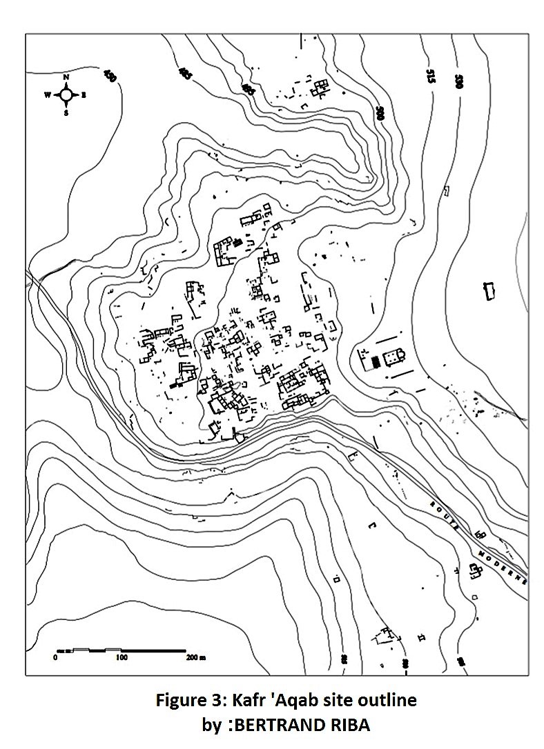
Park No/8/mount Alwastany – Figure (2)
The park includes three villages: Al-Fasouq, Banasra and kafer Oukab, and they are located on the ancient road known as (Antonina),which connects Apamea with Antakya across the mountain. The road used to cross the sites of Toreen, Al-Fasouq, Khrab Soltan and Kafer Oukab where part of it still exists today. This region had not been documented between 2012 and the current time due to the war, and due to its remote and isolated location.
The primary survey of the region revealed that the park was exposed to major damage that differs from one village to another and most of this damage was man-made.
[2] – The team of Idlip Antiquites Center participated in a process of documentation of the archaeological park, which represented by Ammar Kannawi – Ayman Al Nabo – Abdulslam Alhmoo – Munir Kaskas – Hassan Alasmail.
First: Kafer Oukab
It is located in the middle between Al-Fasouk and Banasra and it is locally known as Kafer Toakab. It is the largest site in Al-Wastany Mountain, and it is possible that it was the ancient site of Nyakaba (important military site where the Roman troops were stationed). The village includes many buildings that date back to the Roman period, but most of the structures belong to the Byzantine era. Many of these buildings maintain high walls, Arches and columns. The ruler’s palace is considered the most important building in the site, and a great part of its surrounding walls and interior section is still standing today. There is a Basilica inside the walls that date back to the end of the 5th century AD, and a hall that was converted into a mosque during the Islamic period. The site also includes a group of subterranean reservoirs, the most important one is located about 1km from the village on the side of the mountain.
Additionally, there are many cemeteries on site that were engraved in the rocks, and there are also cemeteries that were built as small towers above the lower parts of the cemeteries engraved in the rocks. These cemeteries spread in the perimeter of the site and on the approximate foothills. There are also many dwellings and vine presses across the site. Figure /3/
The current Condition:
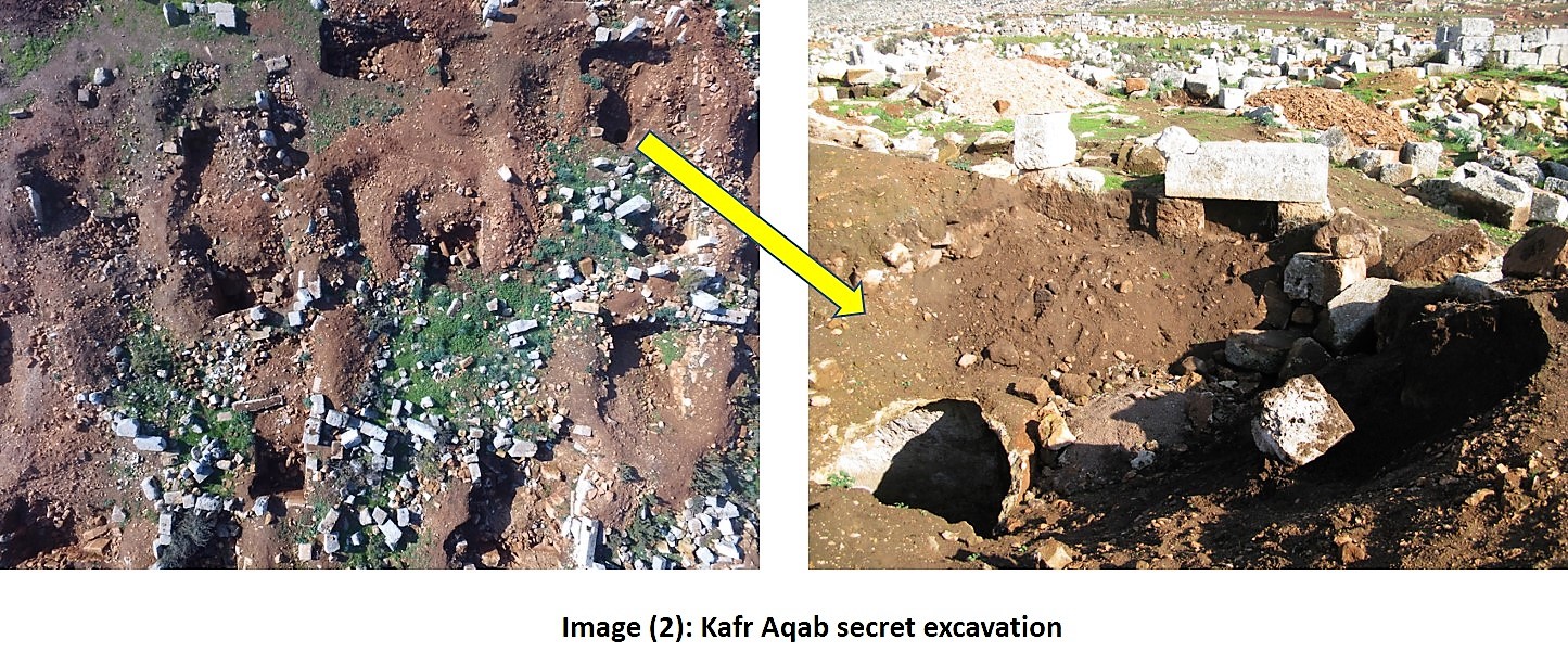
1-Illegal excavations
The random digging caused severe damage to the site of Kafer Oukab’s and it is visible across the site. Heavy machines and equipment, such as bulldozer, have been used in the digging which created deep holes. Accordingly, the stratifications and the archaeological layers of the excavated pits were tampered. Some of the excavations had destroyed the walls, floors, and decorative elements of the archaeological structures, and some had reached the water reservoirs engraved in the rocks. Most of the illegal excavations is concentrated in the western part of the site and in the middle part, and they do exist in other parts of the site. We also noted using electronic devices to ditect metals and cavities inside the layers of the site by some illegal excavators. Image (2)
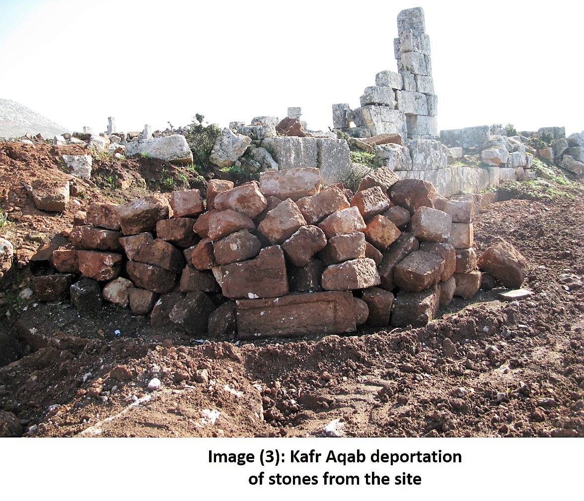
2-Removing the stones of the site:
The activities of the illegal excavations uncovered walls and stone foundations built by small and medium size stones. These stones have been relocated by the local inhabitants who live in neighbored camps to reuse them in the modern building process. On site, we saw sorted piles of stones being prepared to be transferred later where it can be sold to be reused in construction. We were able to identify several buildings around the site and in the camp that were built using the archaeological stones, and some building are still under construction. Image (3)
3-Cutting the archaeological stones
In addition to transporting the stones, there is a process of cutting the large stones of the archaeological buildings into smaller stones that suit the modern buildings, and this process is being conducted on site. Image (4)

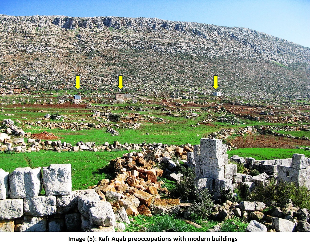
4-Modern encroachments
There are several modern buildings encroaching on the site of Kafer Oukab. Four out of six buildings were built using stones that were transported from the site. These buildings are located to the north east of the site, and they are small buildings that consist mainly of one or two rooms and they provide temporary residences for the internally displaced families. Image (5)
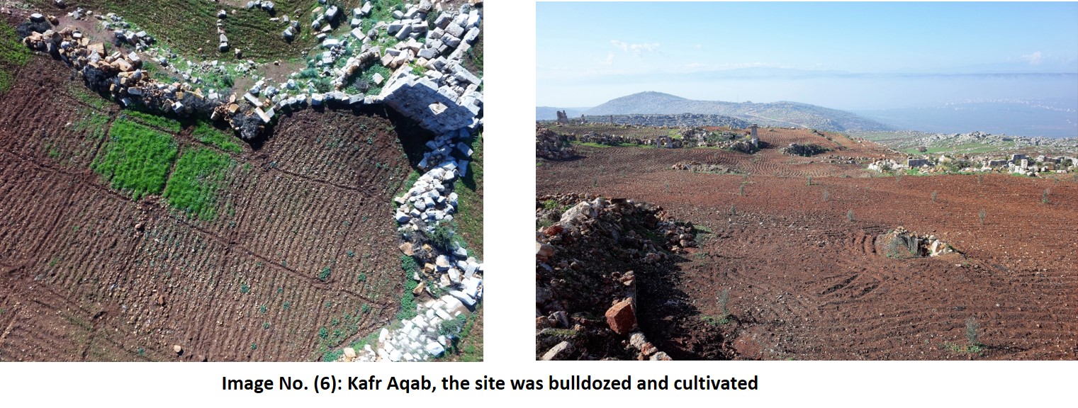
5-The processes of tillage and cultivation
Tillage processes are underway around the site in order to plant olive trees. These fields are mainly of irregular shapes, they are defined by the available area of land. Expansion are made later by dismantling the archaeological walls and removing their debris. This violation is new, it started around the current agricultural season as the farmers were seeking to gain the most possible area of land to plant.
The olive fields spread mainly to the north of the site and the north west, while the fields which are planted with shallow farming spread mainly in the eastern part of the site. Image (6)
6-Housing inside the site
There are evidences of new housing inside the site in the western part of the site. Cement floors for the tents were set up in the site earlier by displaced persons, and there are other facilities like baths but they have been abandoned recently. Image (7)

Second: Al-Fasouq
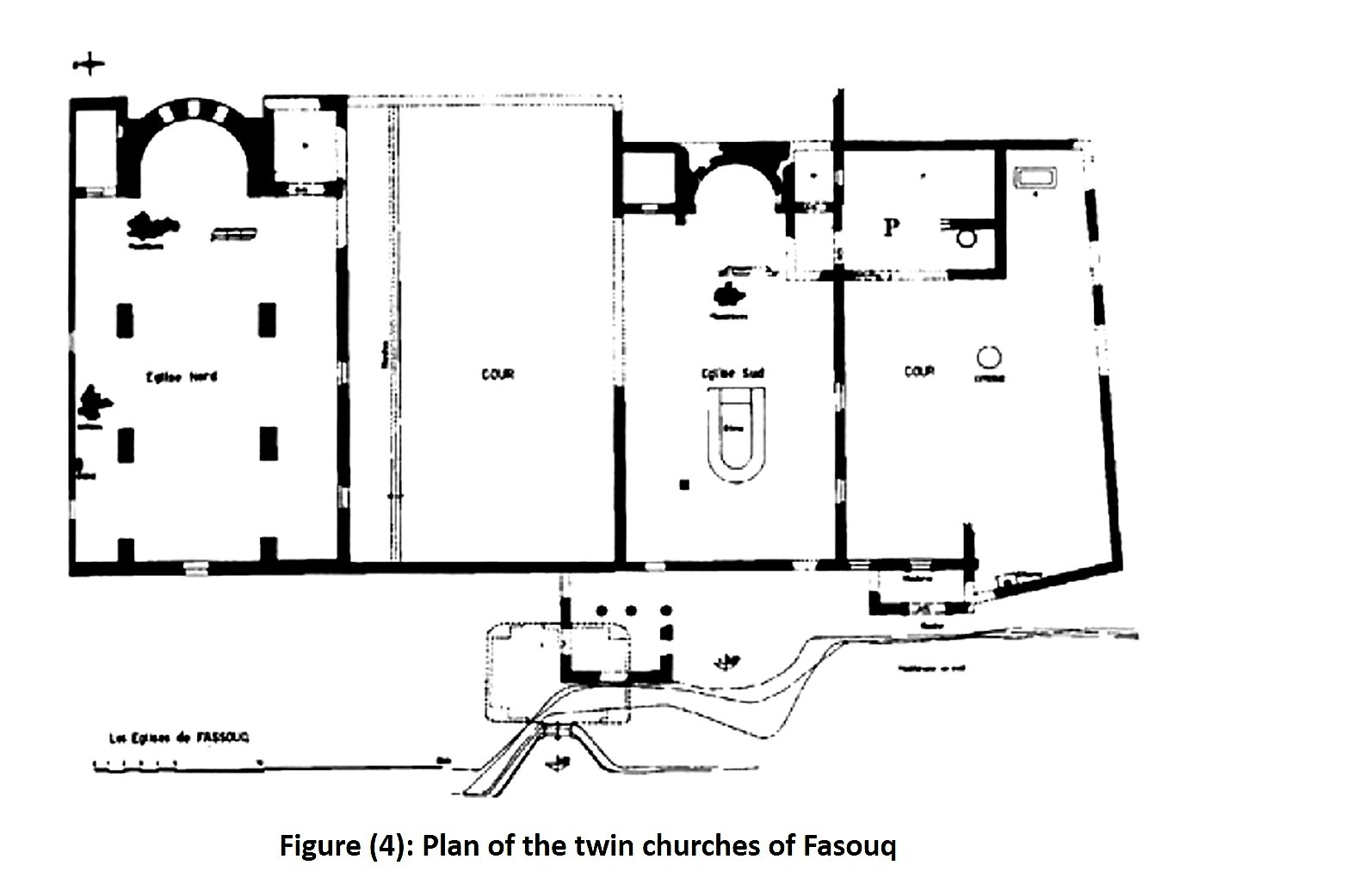
It is located to the south of Kafer Oukab village and it is smaller in area than the aforementioned site. The village enjoys a rich flora, especially Laurel and oak. This site goes back to the Roman era and even before that. There are around 69 residential buildings in this site and several engraved tombs in the rocks. Among the well-preserved archaeological buildings of the site, there are two twin churches, which are still standing until now. Figure (4)
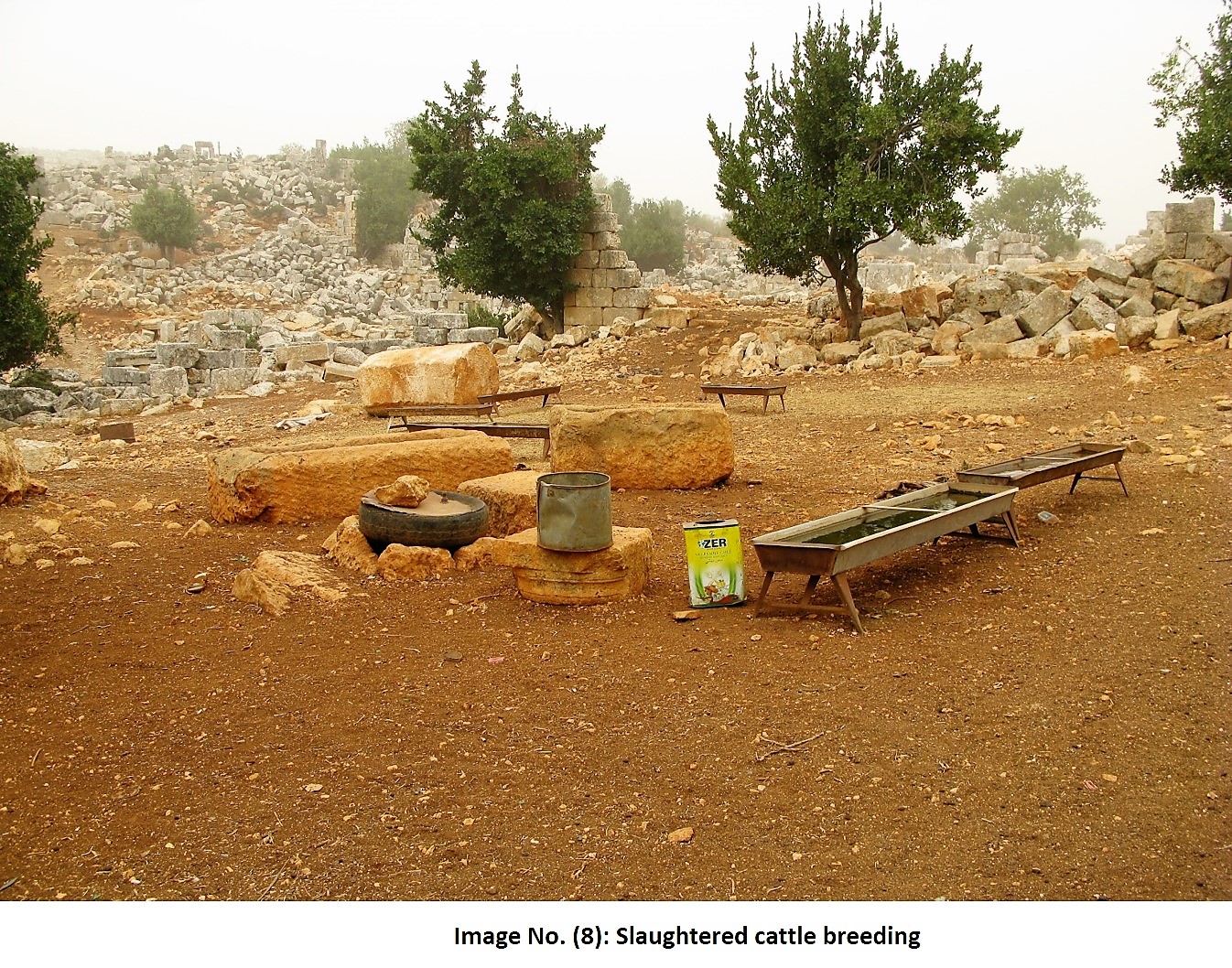
In addition to many residential structures that were built with large stones, there are presses, cemeteries and troughs which indicate raising animals. The site is relatively rich with ornamentation and architectural elements like capitals of columns and decorated linters. The site is home for a small group of local inhabitants who have been using some of the archaeological buildings, caves and cemeteries in raising cattle. Some of the old caves and cemeteries have been used recently as shelters against bombardment. The current inhabitation of the site has preserved the identity of the site and it has maintained the old inherited habits of living, economy and agricultural styles. Image (8)
Current condition
1-Illegal excavations
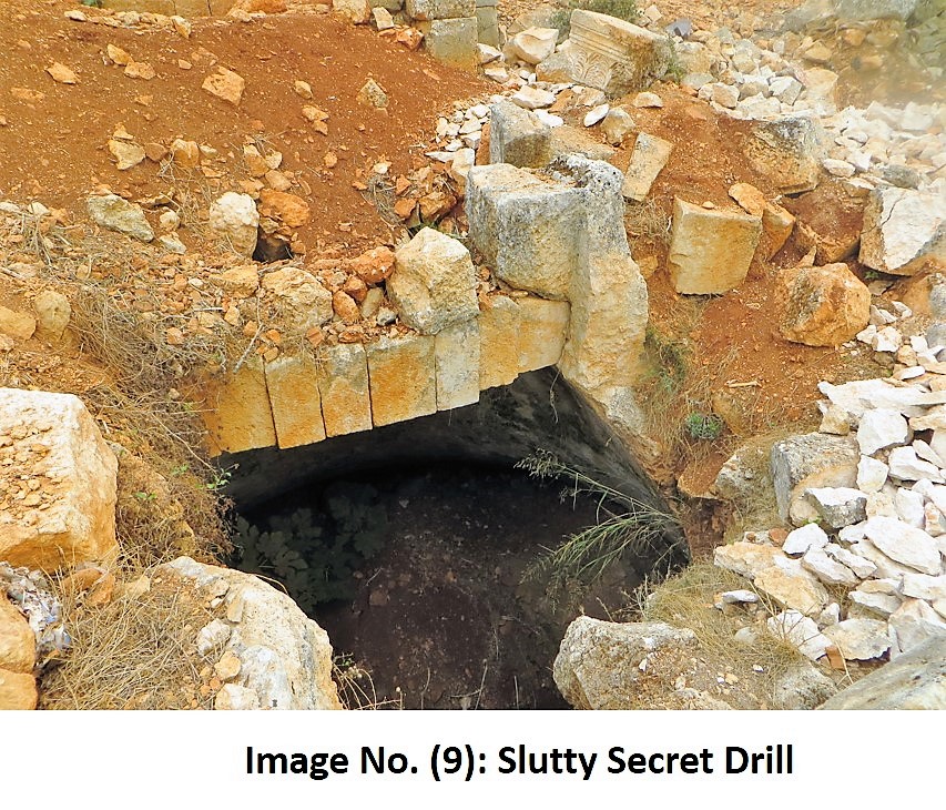
There are minor violations in specific areas of the site, especially in the church where a water reservoir was discovered underneath the church in addition to few archaeological buildings. The excavations didn’t cause severe damage to the fromology and structure of the buildings. These violations date back to the previous 3 years when the inhabitants of the village abandoned the site as a result of bombing and military operations in the region. The violations stopped as soon as the inhabitants returned to the site. Image (9)
2- The modern building
The modern village still has its old planning and it didn’t witness urban expansion as most of the inhabitants migrated through the last period because of the ongoing war in the region. None the less, some modern buildings or some additions to old houses were detected. Additionally, some archaeological buildings engraved in the rock have been used as temporary settlements or for breeding cattle. Image (10)

3- Cutting archaeological stones
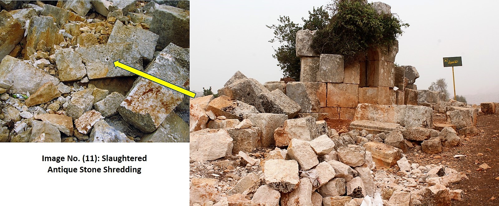
There are a few examples about that kind of violations, especially, in the twin churches. These violations probably go back to a previous period and they don’t spared throughout the archaeological site. The stones are not used in modern buildings. Image (11)
Third: Khrab Banasra
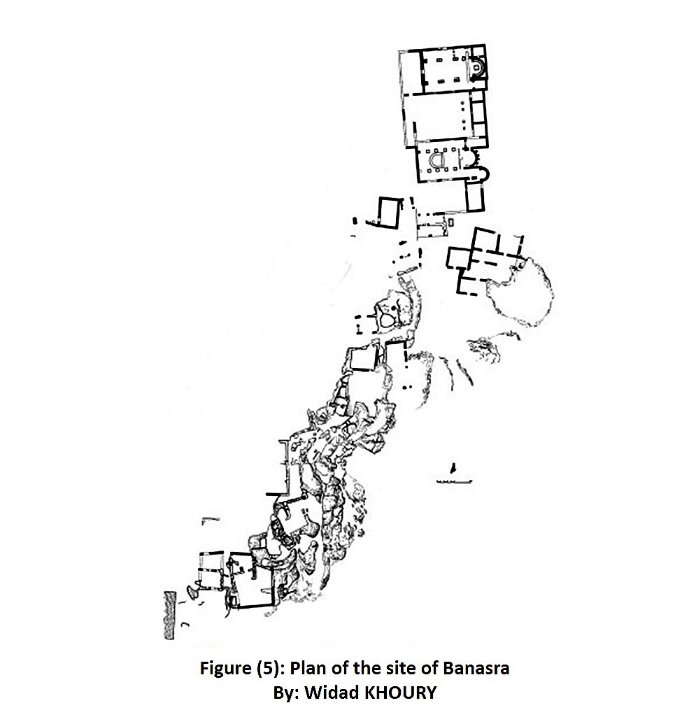
It is a small site in the Lime Massif, and it date back to the Roman-Byzantine era. It is located to the west of Al-Fasouq village in a rugged mountainous region. The site is isolated, it can only be reached on foot. The site sits on the edge of a rocky cliff and it looks up on a valley surrounded by abrupt rocky slopes of a poor greenery.. Figure (5)
Banasra provides an idea about the religious life of the ancient Syrian people and their paganism. it is likely that there was a coexistence between those Pagan groups and the Christian community when Christianity was growing. There are caves that were dedicated to worshipping the Gods of the Syrian society, and small chapels. The first Basilica was built in middle of the 4th century and the second one, which shared its yard, was built in the 6th century. This church embraces unique architectural details, such as the twin columns that share Corinthian capitals. The twin church is the only one that we know of beside Al-Fasouq’s church. In the southern part of the site there are tens of presses for olive and wine. The residential structures rise on the edge of the cliff, which edges were engraved to form parts of the walls. The rest of the structures were built with well-carved large stones. Some of these buildings consist of two story’s or more, and some buildings sit on top of the hill of the rocky cliff. Image (12)
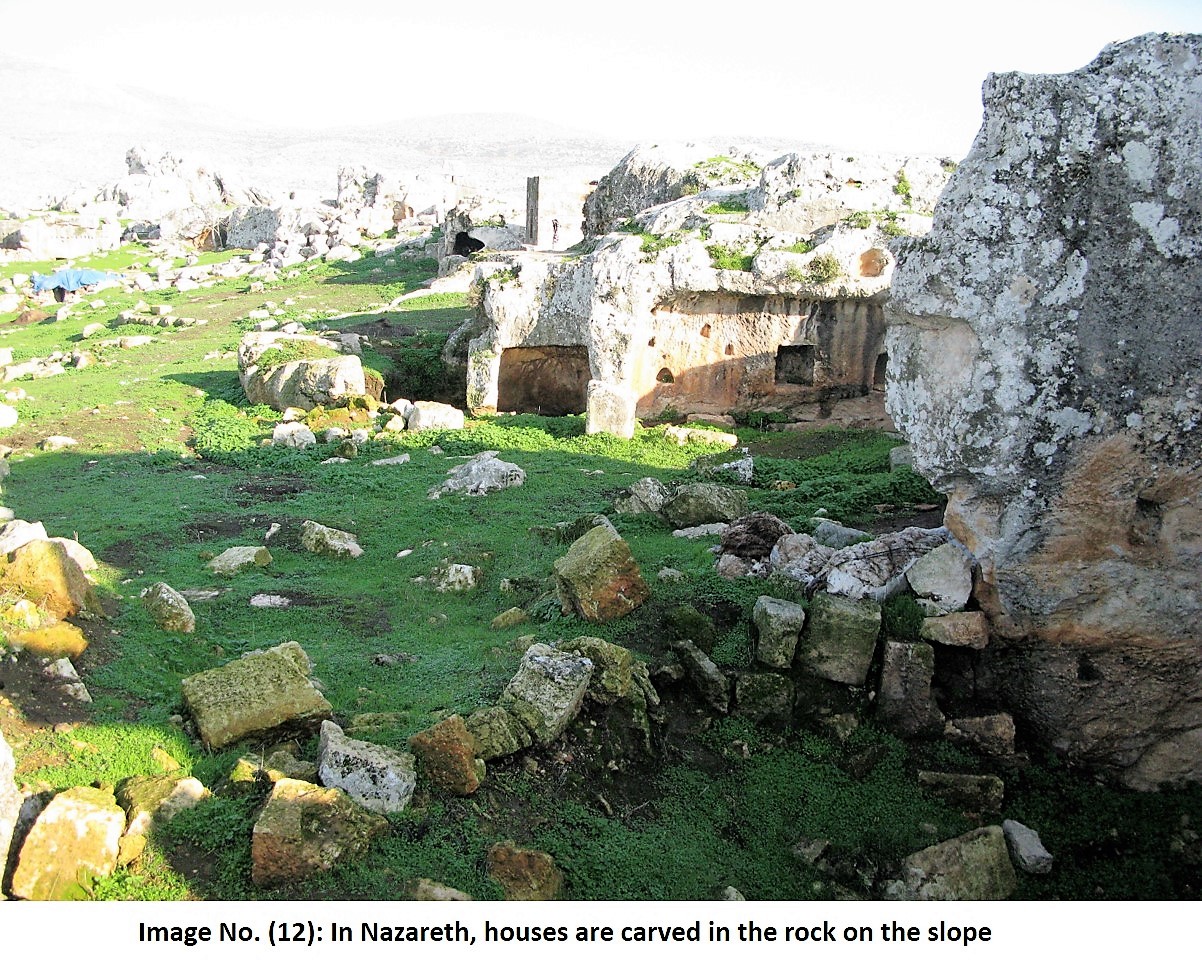
Some archaeological cemeteries engraved in the rocks can be found across the cliff, they are separated from the site by the valley between the two slopes. The site does not have modern houses except only one house. It was built in the middle of the site long time ago and there is one family living in it. The inhabitants work in grazing cattle and their house fits perfectly in the archaeological site as it was built according to the traditional architectural style of the region. Image (13)

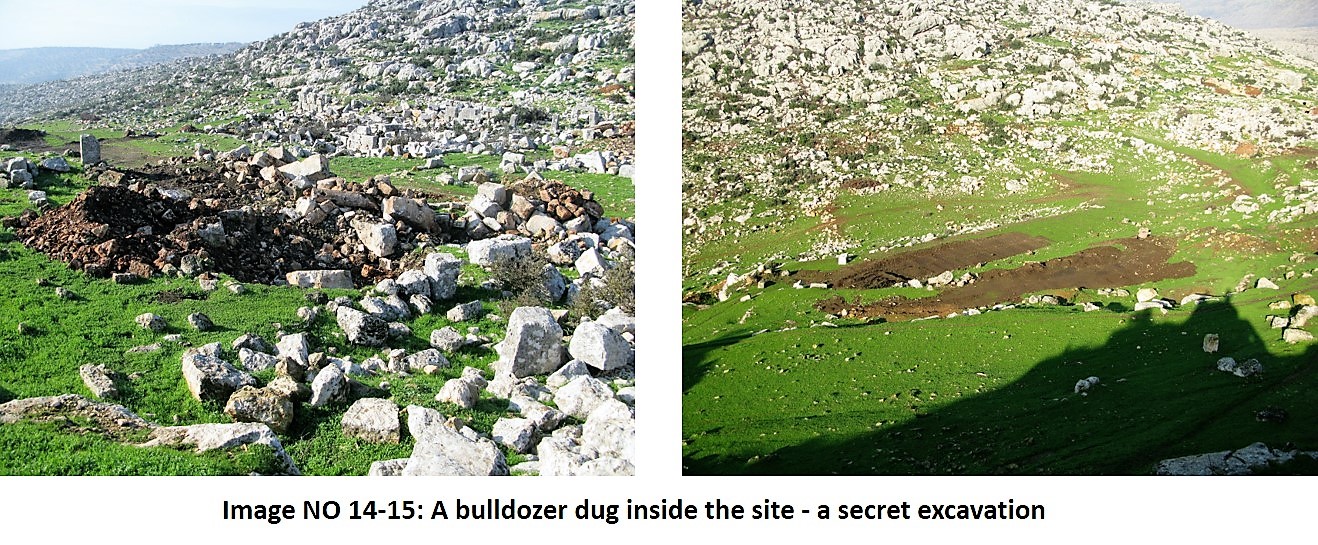
The current condition:
The site is in a good condition in spite of few random illegal excavation activities, which have not caused great damag to the site. There is minor tillage on the side of the site in order to farm the land. The existing house in the site has not harmed the general view or the plan of the site. Image (14-15)
Types of encroachments:
Through studying the three sites, we were able to identify different types of damage affecting the archaeological sites, and we can categorize them according to the level and extent of damage they are causing as following:
1-Illegal excavations
2-cutting the archaeological stones and transporting them from the sites to be reused in modern constructions.
3-Tillage inside the archaeological site in order to use these areas for agricultural purposes.
4-The spread of new buildings in the archaeological sites.
5-Using the archaeological sites for settlement and breeding cattle.
In addition to the aforementioned violations to the archaeological sites, there are violations to the greenery of the region, which includes cutting off the oak and laurel trees in order to use their wood for heating during winter. This is especially happening in Kafer Oukab’s site, whereas the greenery of Al-Fasouq site remains intact. Cutting off the trees of Kafer Oukab site and replacing them with olive trees affects the flora of the site and it changes its natural characteristics, which was one of the reasons why the site was inscribed on the World Heritage Site List.
Reasons of violations:
The main factor behind these violations is the absence of an archaeological authority to monitor the sites and lacking an executive body among the organizations of the civil society including The Idlib Antiquity Center that can incriminate these violations and fight them. This is probably due to the security gap in the region and lacking the needed awareness in the society about the importance of preserving heritage.
The absence of a united authority in managing the regions of the western north of Syria and the existence of different military sides is a great obstacle to introducing a law to protect the archaeological sites in the region.
More important is the impact of the demographic engineering of the country, which has changed the social structure of the region and turned it into a shelter for the displaced and migrants from the different parts of the country. This dangerous humanitarian crisis reflected greatly on the different aspects of life in the region including the preservation of the archaeological sites. In this crisis the new arrivals found in the archaeological sites a temporary shelter for them, and they found in the archaeological stones a cheap material for building.
–The result
Comparing the damage in the three sites; we noted the great extent of the violations in the isolated and the uninhabited site of Kafer Oukab, whereas the violations in Al-Fasouq site are scarce. That is mainly because the local inhabitants of the village provide a relative protection for the site. The remote and isolated site of Banasra, on the other hand, are extremely minor.
Image (16)
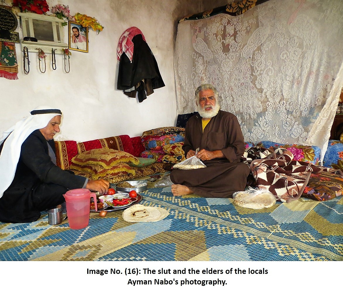
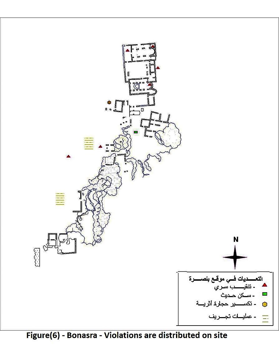
The isolated location of Banasra site and lacking the proper roads to reach it have protected the site. Moreover, the lands surrounding the site are owned by a family that is actively protecting its properties, which has contributed to the preservation of the site. Figure (6)
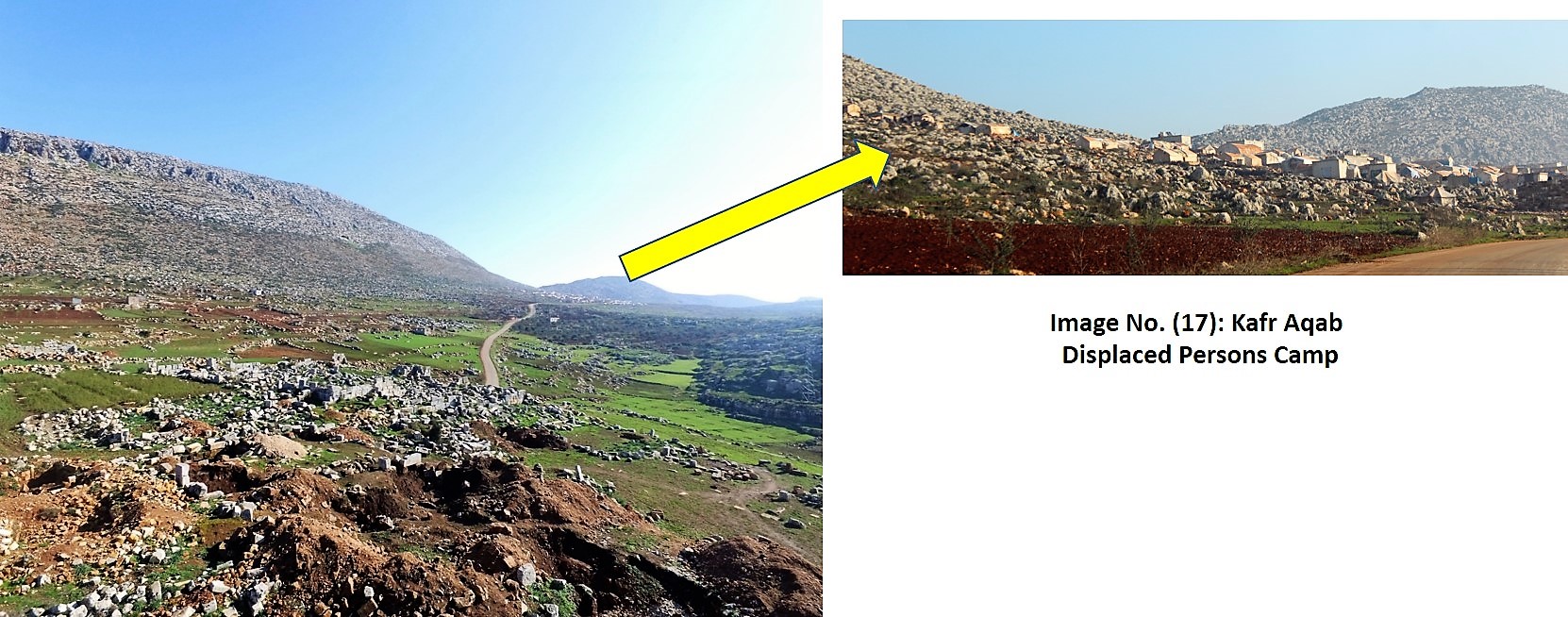
The archaeological site of Kafer Oukab has been exposed to a considerable level of damage mainly due to its proximity to a camp for refugees located around 2km to east north the site[3].
. Image (17)
Summary:
This report aims at providing a comprehensive analysis for the damage affecting the archaeological sites in the region of the Central Mountain, and the region of the Lime Massif in general. Further work is needed to continue to monitor the condition of the Dead Cities, especially, that they fall in an extremely unstable area where there are constantly bombardment and battles, resettlement and displacement.
At the Idlib Antiquity Center, we are vigorously working to introduce a temporary law for the protection of cultural properties and circulating this law on the local councils in the archaeological sites to prevent atrocities and to engage the local community in the preservation and protection processes. In order to actually protect these cultural properties, however, it is essential for the international organization, such as UNESCO, to step up and meet their responsibilities in the protection of Syrian heritage.
[I] – A project of documentation to the Archaeological park in the Alwastany mount has been done under a scientific supervision by the D. Abdalrazzaq Moaz and by financing from Girda Hankle the Germany foundation.
[II] – The team of Idlip Antiquites Center participated in a process of documentation of the archaeological park, which represented by Ammar Kannawi – Ayman Al Nabo – Abdulslam Alhmoo – Munir Kaskas – Hassan Alasmail.
[III] – Preparing diagrams for the damages and transgressions on the archaeological sites were achieved by Abdulslam Alhmoo.